DISTANCE FROM OLLEROS: 37 Km.
Duration: 3 days - 2 nights.
ALTITUDE: 4,700 m.
DEGREE OF DIFFICULTY: Easy to moderate
STARTING POINT: OLLEROS 3,450 m.
MOUNTAINS:
Shaqsha 5,703 m. Cashan 5,686 m.
HUATZAN, RUREC, Uruashraju, Pucaraju, Yanamarey
It is a route used by the Incas Pre to connect the Callejon de Huaylas with the Valley of the Conchucos, which are the archaeological remains of the great temple of Chavin.This is a trek that crosses the Cordillera Blanca, through the passage of Yanashallash of 4,680 m.Throughout the three days of walking, we will know diverse natural landscapes and snow-capped beauty.
PROGRAM:
01: Huaraz - Olleros - Canrey Chico - Sacracancha (4,000)
Is part of Huaraz and head south to Km. 27, taking the road to the left to reach Olleros (3,450), from where you start the trek towards the East, to take Uquián Valley to the small town of Sacracancha (4,000 m.) where will the first camp (5 hours) is, appreciating the Nevados de Shaqsha, Cashan, Rurec, Huatzan, Rurec, Uruashraju, Pucaraju and Yanamarey
02: Sacracancha - Yanashallash (4,700) - Quebrada SHONCOPAMPA (4,050).
Following the same valley Yanashallash arrive at step (4700), from which it may spot some of the peaks of the Cordillera Blanca, and especially the Valley of the East, to continue along the gorge of SHONCOPAMPA, to the junction of the valley going to the town center SHONCOPAMPA (4,050 m.), where will the second camp (7 hrs.) is.
03: Quebrada SHONCOPAMPA - Chavin (3,140) - Huaraz
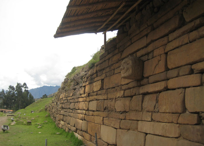
The walk starts very early and taking the same path that goes for Jato and following the Huachecsa gorge to reach the archaeological site of Chavin (3,140) (4 hrs.), and to appreciate the great craftsmanship of the carvings the Chavinenses stone as one of the most important cultures of this region, before returning to the city of Huaraz
End of our services

